


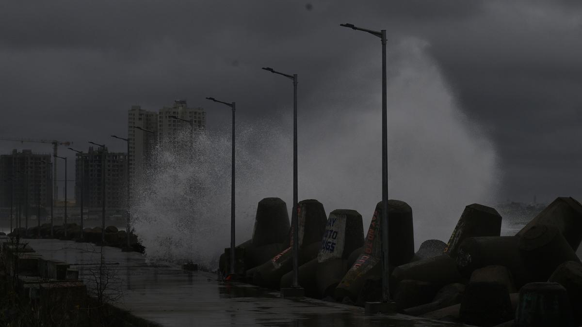

Giant waves driven by Cyclone Ditwah strike the coast at Kasimedu fishing harbour in Chennai on November 30, 2025.
| Photo Credit: B. Jothi Ramalingam
Cyclonic storm Ditwah, positioned close to north Tamil Nadu–Puducherry coast, continued its slow northward movement on Sunday (November 30, 2025) even as it began to weaken.
According to the Regional Meteorological Centre (RMC), the system moved at a speed of 5 kmph on Sunday morning (November 30, 2025) over southwest Bay of Bengal and adjoining north Tamil Nadu–Puducherry coast. The minimum distance of its centre from the coastline was around 80 km.
The RMC said the cyclone moved nearly northwards parallel to the coast and weakened into a deep depression by Sunday (November 30, 2025) night. By midnight on November 30, 2025, the system was to remain over southwest Bay of Bengal at a minimum distance of about 30 km from the north Tamil Nadu–Puducherry coastline.
Forecast for December 1
For Monday (December 1), light to moderate rain is likely at isolated places over Tamil Nadu and Puducherry–Karaikal, with thunderstorms and lightning at a few places. Heavy rain is likely at isolated places in Tiruvallur district, according to the RMC bulletin.
Gale winds are likely to decrease gradually, becoming squally with speeds of 45–55 kmph, gusting up to 65 kmph, by the morning of Monday. Sea condition is very likely to improve gradually, becoming very rough to rough by the morning of Monday and improving further thereafter, the RMC said.
Published – November 30, 2025 10:01 pm IST