


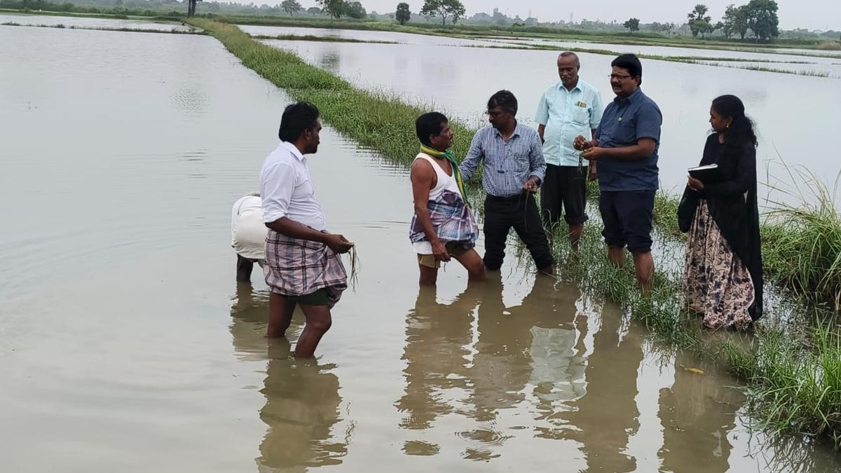

Agriculture Department officials assessing a paddy field submerged at Palaiyur village in Nagapattinam taluk after Cyclone Ditwah.
| Photo Credit: Special arrangement
Due to protests from farmers’ organisations in the Cauvery delta, the Tamil Nadu government has scaled down the app-based GPS verification for assessing the crops damaged by heavy rain triggered by Cyclone Ditwah and has permitted conventional joint field inspection for the bulk of the enumeration.
The Department of Agriculture has now revised the protocol, making GPS-enabled verification mandatory for only 10% of the affected area, while allowing the remaining assessment to be completed through joint inspection with Revenue officials, using conventional field verification and visual estimation, as followed in earlier calamity surveys. The relaxation, announced on Friday, is expected to speed up damage estimation and compensation processing in Thanjavur, Tiruvarur, Mayiladuthurai, and Nagapattinam districts, where thousands of hectares remain affected by prolonged submergence.
In the immediate aftermath of the cyclone, the Agriculture Department had directed field staff to carry out damage assessment through a mobile app with GPS tagging, requiring Assistant Agricultural Officers (AAOs) to be physically present in the affected fields to record damage digitally. Farmer bodies, however, contended that the method was proving impractical in flooded tracts and could result in under-reporting, especially in interior villages with weak network coverage and in fields where standing water and slush made entry difficult and unsafe.
A Joint Director of the department from a delta district said the 10% app-based coverage would serve as a sample check, while the rest of the enumeration would proceed without the bottlenecks triggered by the app-only requirement. The relaxation also comes against the backdrop of manpower constraints in the delta blocks. Farmers’ groups have repeatedly highlighted that AAOs are responsible for large jurisdictions, leaving them stretched thin during peak field operations, particularly when every damaged patch has to be visited, verified and uploaded through a digital workflow. Network issues, delays in geo-tagging and time required to physically reach scattered plots had slowed enumeration in several villages, they said, even as farmers pressed for swift survey completion to ensure timely relief.
To accelerate the process, the government has ordered deputation of AAOs from non-delta districts, with over 250 officers deployed across the four affected districts to reinforce the enumeration drive. Officials said the additional hands, coupled with the revised method, would help complete the assessment faster and reduce the backlog in areas where standing water had delayed field access.
Progress, officials acknowledged, has been uneven across districts, reflecting differences in the extent of submergence, accessibility of fields and available staff strength. In Thanjavur, officials have reported 4,460 hectares as affected, with about 40% physically assessed so far. In Tiruvarur, 13,399 hectares have been recorded as affected, and around 60% of the assessment has been completed. In Nagapattinam, damage has been reported in 22,822 hectares, with nearly 40% covered so far, including about 8,200 hectares verified through manual inspection. In Mayiladuthurai, officials have reported 15,569 hectares as affected, with about 50% of the enumeration completed.
S. Dhanapalan, general secretary of the Cauvery Farmers Protection Association, welcomed the relaxation and said digital tools were unavoidable in the long run, but the system had to match field realities. “Digital method is the necessity of the age. Still, at the village level, internet and field conditions make it difficult to identify those genuinely affected in real time. Making 10% verification mandatory is welcome,” he said.
Mr. Dhanapalan also flagged the staff shortage as a structural constraint that routinely affects field operations. He said that in several pockets, one AAO is expected to cover as many as 17 revenue villages, making intensive field verification difficult during disasters. “In practice, an officer can efficiently look after only two or three revenue villages if the survey has to be done properly on the ground,” he said.
Published – December 14, 2025 01:00 am IST