


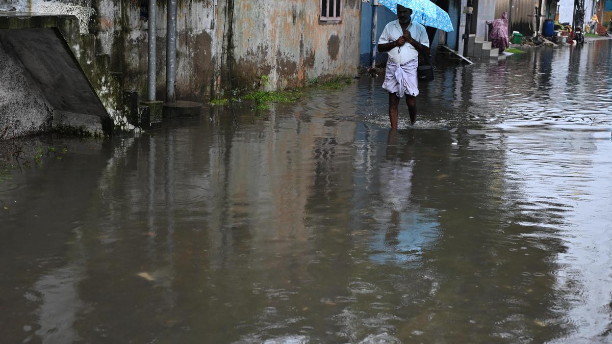

During the 24 hours ending 8.30 a.m. on Thursday, areas in north Chennai bore the brunt of the downpour with Manali New Town logging 24 cm, followed by Ennore 21 cm, Wimco Nagar 20 cm, and Kathivakkam 16 cm.
| Photo Credit: B. Jothi Ramalingam
After lashing Chennai and Tiruvallur for three days, the rain is expected to shift to south-coastal Tamil Nadu as Cyclone Ditwah’s remnant continues to dissipate. A weather system over the Arabian Sea is likely to trigger heavy rain over the south-coastal districts on Friday.
With intermittent rainfall persisting over northern districts on Thursday, the Regional Meteorological Centre (RMC) revised the heavy rainfall warning for districts, including Chennai and its neighbours, Vellore, and Tiruvannamalai. At the same time, Tenkasi, Thoothukudi, Tirunelveli, and the ghat areas of the Nilgiris and Coimbatore were placed under a yellow alert.
Officials of the RMC said the prevailing upper air cyclonic circulation over the southeast Arabian Sea and adjoining Lakshadweep was likely to sustain heavy rainfall over Tenkasi, Thoothukudi, and Tirunelveli and the ghat areas on Friday. Scattered rain is likely across the State. Chennai, which was pounded by rain since the start of the week, may get a respite as rainfall is expected to ease to light/moderate intensity on Friday.
During the 24 hours ending 8.30 a.m. on Thursday, north Chennai areas bore the brunt of the downpour with Manali New Town logging 24 cm, followed by Ennore 21 cm, Wimco Nagar 20 cm, and Kathivakkam 16 cm. Several neighbourhoods in and around Chennai, Tiruvallur, and other districts, such as Kallakurichi, Perambalur, and Coimbatore, also saw spells of light to heavy rainfall.
Cyclone Ditwah and its remnant, which skimmed the Tamil Nadu coast, dumped widespread rainfall over the delta and northern districts and continued to trigger rainfall even as it drifted inland over nearly a week. Chennai has touched its normal seasonal rainfall, recording 70 cm against the average of 69 cm since October 1 as the system helped erase the deficit. However, some districts, including Chengalpattu, Tiruppur, and Perambalur, continue to remain in a rainfall deficit.
According to the RMC, the remnant of the cyclone weakened into a low-pressure area over north Tamil Nadu on Wednesday and further lost strength by Thursday morning. Various places, including Chennai, Vellore, and Ranipet, recorded light rain till 6 p.m. B. Amudha, Head, (Additional in-charge), RMC, said the remnant, though a feeble system, remained persistent and kept the northern districts under cloudy skies with intermittent rain on Thursday.
But with the ground already saturated after the past few days of intense rainfall, even a small spell can cause inconvenience. So, a yellow alert was issued on Thursday, she said. Tamil Nadu may get a break from rainfall till December 10. With a drop in inflow, the water release from the Red Hills reservoir was reduced to 1,500 cusecs on Thursday.
Published – December 04, 2025 09:24 pm IST