


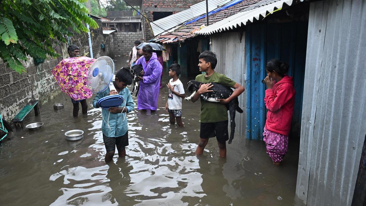

Residents leaving homes that have been inundated by rain due to Cyclone Ditwah at Gandhi Nagar in Rameswaram on Saturday.
| Photo Credit: L. BALACHANDAR
At least three cyclones in the past have had an origin similar to Cyclone Ditwah and moved parallel to the Tamil Nadu coastline. Among them, Cyclone Nisha, which struck in November 2008, has been the most recent and most similar.
Cyclone Nisha, which formed over the Comorin area, was tracked along the coast before making landfall in the delta region on November 27.
“No two cyclones are alike. But we can track depressions or cyclonic storms that either had similar origins or followed a somewhat similar path to Cyclone Ditwah,” said Y.E.A. Raj, former Deputy Director-General of Meteorology, Chennai.
Pointing out that the weather system formed near the Comorin area at a low latitude and had intensified rapidly, he said it could be called a marginal cyclone.
A few depressions and cyclonic storms, including one in October 1982, have had tracks slightly similar to Cyclone Ditwah. A deep depression over the Bay of Bengal, which passed northeast of Sri Lanka, approached the Tamil Nadu coast on December 20, 1993. It caused heavy rainfall in the State and Puducherry.
In December 1983, a low-pressure area over the Bay of Bengal concentrated into a depression over Sri Lanka and travelled through the landmass. It crossed the south Tamil Nadu coast near Adiramapattinam on December 23 before weakening over the interior parts of Tamil Nadu and Kerala.
It brought heavy to very heavy rainfall in places such as Nagapattinam, Karaikal, and Mannargudi, Mr. Raj said.
Weather blogger K. Srikanth, who runs the Chennaiyil Oru Mazhaikalam blog, said: “Cyclone Ogni [October 2006] was one of the systems that had a track that closely resembles Ditwah’s. Though Ogni did not travel over Sri Lanka, it originated over the Comorin area and continued moving parallel to the Chennai coast.”
Land interactions
Cyclone Ditwah stands out for its prolonged interaction with land, having spent over 36 hours on the Sri Lankan landmass before moving towards the Tamil Nadu coast.
Cyclone Nisha, which affected both Sri Lanka and Tamil Nadu, also spent significant time travelling over Sri Lanka before its landfall north of Karaikal, causing heavy flooding. Cyclone Roanu of May 2016 also had a similar trajectory and formed east of Sri Lanka and travelled along the Tamil Nadu coast. But it did not get close to Chennai, Mr. Srikanth added.
Meanwhile, north-coastal districts are on alert as strong surface winds of 60-70 kmph, gusting up to 80 kmph, are expected to prevail on Sunday as Cyclone Ditwah moves closer to the Chennai coastline. While Tiruvallur and Ranipet districts are likely to experience extremely heavy rain, nine districts, including Chennai and Krishnagiri, may receive heavy to very heavy rainfall. Officials of the Regional Meteorological Centre said Chennai would start receiving intermittent spells of heavy to very heavy rainfall from Saturday night.
B. Amudha, Head, (Additional in-charge), Regional Meteorological Centre, said places such as Karaikal and Nagapattinam continued to receive intense rainfall on Saturday, logging 15 cm and 11 cm respectively till 6 p.m.
Wind recorders in places such as Chennai, Ennore, and Pamban recorded strong winds of 40 kmph and 60 kmph. With the State’s November rainfall remaining at a deficit — 13 cm against a normal of 18 cm — Cyclone Ditwah is expected to reduce the shortfall. However, seasonal rainfall since October 1 remains 3% above the normal of 35 cm, Ms. Amudha added.
Published – November 29, 2025 10:54 pm IST