


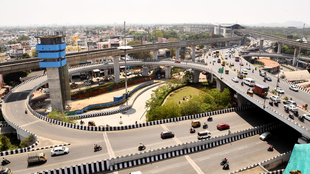

The earliest record of Kathipara can be traced back to the 1960s. File
| Photo Credit: The Hindu
WhatsApp University has no doubts whatsoever. It says Kathipara acquired its name because of the scissor-like manner in which the roads on the clover there cut across each other. The earliest record I can trace of Kathipara is from the 1960s. So clearly, whoever gave the place its name was prescient.
Kathipara Road exists in district administration manuals of Saidapet and Chengalpattu from the 1960s and so it clearly was a village of that name. In my view, the name has something to do with the stationing of the East India Company’s garrison at St Thomas Mount though I am no closer to explaining the name that way.
The entire area has a lot of streets that have Army connotations — Lashkarkhana (a camp), Asarghana (Afsar Khana or Officer’s Enclave), Butt Road (there was a rifle practice butt here), Magazine Road, North Parade, etc. And the para in Kathipara was probably pahra — which means a guard post. It must not be forgotten that this was after all the southern border of Madras city for long, separating it from Chengalpattu.
What is overlooked is that we have a Kathbada in the northern end of our city too. That is in Fort Tondiarpet, just north of where the Town Wall once existed. In fact, Kathbada Road very clearly defines its purpose. It exactly follows the contour of the town wall, north of Old Jail Road/Ebrahim Sahib Salai and stretches west to east, connecting Buckingham Canal to Washermanpet. In other words, it was the northern bound of the city, linking two important exits from the old town — to Kathivakkam and Tiruvottiyur. Both were old villages that the East India Company was very heavily invested in.
And so, both the northern and southern extremities of our city had Kathbada/Kathipara. Kathipara had a garrison close by at St Thomas Mount. Kathbada too had Army presence for a while before the unit moved to Perambur in an area that is still known as Pattalam or garrison. Sadly for us, relying as we do on modern day maps, both areas have undergone major transformations.
The northern Kathbada was changed beyond recognition even in the 1850s when the railway line was laid close by. The Buckingham Canal came shortly thereafter and in more recent times, the flyovers have played havoc with local markers. Even the old wall, a significant part of which existed within the Stanley campus, has since been demolished leaving just Madi Poonga. As for Kathipara, it is the much-needed clover that dominates, leaving the rest to our imagination. And then we have had Chennai Metrorail as well, yet another essential addition but which has obliterated a lot of earlier markers.
That said, I am no closer to explaining what Kathipara or Kathbada stands for. Are they the same? Even that is not clear. And while pahra may be explained easily enough, Kathi or Kath is not that simple. It seems to be a corruption of a word of Urdu or Persian origin. Interestingly, there is a Kathpara Bazaar in Nowgong in Assam, also an army location at one time! And Madhya Pradesh has its Garhpehra — the frontier fort located at Sagar. These may have of course not had anything to do with our Kathipara.
While on the subject of Kathipara, a few more queries – who is Paul Wells who is commemorated in a road in that area? Who is Vembuli Subedar who too has a road in his honour? And why Seven Wells Road? Like North Madras did Kathipara too have seven wells?
(V. Sriram is a writer and historian.)
Published – October 01, 2025 06:00 am IST