







The story so far: The proposed Mamallan Reservoir in Chengalpattu district is being presented as a solution to two problems facing the rapidly urbanising southern parts of the Chennai Metropolitan Area — drinking water shortage and flooding. But the project is also being built in a landscape of marshes, salt pans, backwaters, and wetlands that supports fishing and provides feeding and roosting habitat for birds. This has raised concerns among fishing communities, residents, and environmental groups over its potential impact on wetlands, fisheries, and local hydrology.
Who has initiated this project and what is its status?
The reservoir has been proposed by the Water Resources Department (WRD) in the Kovalam sub-basin between the Old Mahabalipuram Road (OMR) and East Coast Road (ECR), stretching across parts of Thiruporur and Thirukalukundram taluks. The project received Coastal Regulation Zone (CRZ) clearance, and construction formally began in January 2026 during the erstwhile DMK regime. The incumbent TVK-led coalition government is also backing the project.

What exactly is Mamallan Reservoir?
The Phase-I project proposes a reservoir over 1,770.5 hectares, or 4,375 acres, with a water-spread area of about 17.71 sq km. It will have a storage depth of three metres and a single-filling capacity of 1.655 TMC, with an annual storage capacity of about 2.25 TMC.
A 30-km-plus earthen bund, peripheral drains, and a network of inlet, outlet, and offtake regulators are proposed to create and operate the reservoir.
The reservoir will receive water from a large catchment of 41,408 hectares. About 29,642 hectares of this catchment is intercepted by a cascade of 69 tanks, while another 11,766 hectares is free catchment.

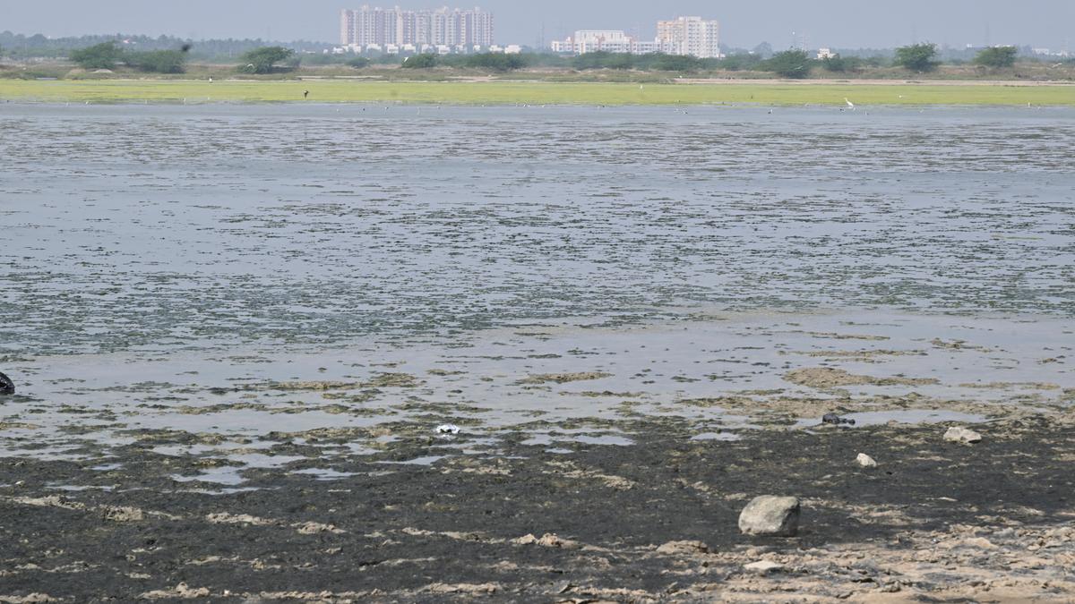
The IIT-Madras Technical Evaluation Report describes the proposed site as being influenced by both tidal waters and freshwater flows from the hinterland. It notes that the wetlands currently support inland fisheries and salt pans operated by the Tamil Nadu Salt Corporation.
The report says around 7,125 acres of these wetlands are classified as government land in revenue records, which means that the reservoir involves fundamentally changing the character and hydrology of an existing wetland landscape.
Why does the T.N. government want to construct the reservoir?
The project documents cite Chennai’s growing water demand as the primary reason for the reservoir.

The Rapid Environmental Impact Assessment (REIA) says rapid urbanisation and industrial expansion have increased water consumption and affected existing drainage systems. It says Chennai’s average drinking water supply is around 700–800 MLD, against a demand of more than 1,100 MLD, and describes the water situation as precarious.
The IIT-M report similarly notes the growing gap between water supply and demand and says groundwater over-exploitation has contributed to seawater intrusion. It describes coastal reservoirs as a different approach to water storage because they can capture excess runoff at the lower end of a catchment. As per this report, the proposed reservoir is a “promising project” with the potential to augment groundwater recharge, check seawater intrusion, and supplement Chennai’s water supply.
The reservoir is expected to supply up to 170 MLD for nine months a year. The project documents say it will serve around 50,000 people in 12 villages, including Nemmeli, Krishnankaranai, Pattipulam, Salavankuppam, Paiyanur, Thandalam, Kalavakkam, Thiruporur, Thiruvidanthai, Punjeri, Kadambadi, and Mamallapuram, apart from developing areas of the southern CMA.

The WRD also sees the reservoir as a flood-management structure. By storing surplus runoff from the upstream tank system, it says, the reservoir can reduce inundation, recharge groundwater, and check seawater intrusion. Surplus water from the 69 upstream tanks and the free catchment flows towards the low-lying area before eventually reaching the sea through the Muttukadu and Kokilamedu estuaries. The reservoir, according to the WRD, would provide storage and controlled drainage.
What lies in the area where the reservoir is proposed?
The EIA’s own ecological assessment says the project area comprises approximately 65% kazhuveli (passage to backwaters) marshy land and 35% uppankali (backwater) salt pans. It records water depths of between 0.5 and 1.5 feet across most of the site and says the area supports floral and faunal diversity, particularly waders and migratory birds that use it for feeding and roosting during the monsoon.
The field survey recorded 102 bird species, including 16 large waders, 18 small waders, 20 water birds, and 48 terrestrial species. The EIA also notes that most of the wader species were recorded around Nemmeli and Vadanemmeli.

Although it is not a Ramsar site or a notified wetland under the Wetlands of India database, environmentalists say that the landscape supports huge biodiversity.
According to K.V. Sudhakar, president of Madras Naturalists Society, a marshland like this can never be replaced. “Its biodiversity treasures are most visible during the monsoons, but even during the dry season, the scrub, grasslands, and salt marsh are important biodiversity refuges. The marshlands are vital habitat for more than 135 dry season species, which includes Migratory Species, Endemic Species (Indian subcontinent), Red List Species (IUCN), High Conservation Priority Species (SOIB), and Schedule-1 Species (WLPA),” he said in July.
What will happen to the wetland?
The EIA acknowledges that the reservoir will substantially alter the existing hydrology. Its impact assessment says water levels, currently generally between 0.5 and 1.5 feet across most of the area, could rise to about three metres when the reservoir is filled. It says the kazhuveli ecosystem could consequently change into an aquatic ecosystem, with wading birds losing some of their existing feeding and resting areas.

The report estimates that nearly 46 wading bird species could face pressure on their feeding practices. It proposes compensatory wetland creation and six artificial islands inside the reservoir to provide alternative roosting and feeding areas.
The EIA proposes converting about 5.12 sq km of abandoned salt-pan areas on either side of the project into kazhuveli habitat, while maintaining an existing 3.45-sq-km kazhuveli area near Kokilamedu. It also proposes six artificial islands within the reservoir.
The ecological assessment’s conclusion is particularly revealing. It says the reservoir is expected to “alter the natural hydrological gradient”, resulting in a moderate impact on wader populations dependent on exposed shallow feeding areas. At the same time, it says deeper-water species such as pelicans, cormorants, and ducks could adapt and increase locally.
Why are locals worried about making it a reservoir?
Residents and environmental groups argue that the existing wetland itself is part of the region’s flood-management system. They say the marshes and backwaters temporarily store excess rainwater and allow it to drain towards the sea. Their concern is that replacing this landscape with bunds, regulators, and a controlled freshwater reservoir could alter the way water moves through the basin.

J. Prasanth of the Chennai Climate Action Group has described the site as a “dynamic tidal landscape” and argued that converting it into a freshwater reservoir could obstruct floodwater discharge when heavy rain coincides with high tides or storm surges.
A government-commissioned coastal inundation map from 2018 has also been cited by opponents. It indicates that large portions of the proposed reservoir area could experience 3.5-4.5 metres of inundation during severe sea conditions.
The CRZ clearance consequently requires a disaster-risk management plan covering cyclones, floods, and storm surges, along with 2D/3D hydrodynamic modelling and measures to prevent upstream backwater flooding.
Further, the fishing communities say the Kovalam estuary depends on the exchange between seawater and freshwater. They fear that restricting seawater intrusion could affect fish, prawn, and crab breeding and therefore, their livelihoods.
In their petition, administrators of Kovalam Kuppam said the project could disrupt the “natural estuarine hydrodynamics” of the area and affect fish breeding cycles.
Recognising this as a critical issue, the CRZ clearance requires a minimum 60% ecological flow, baseline salinity monitoring, a scientifically derived freshwater-conversion timeline, and continuous environmental and salinity monitoring. It also specifically states that the Kovalam estuary should not be adversely affected.

What next?
The local community and stakeholders continue to oppose the project. In the meantime, the WRD has halted the construction work temporarily to review the project design.
The WRD, earlier in September, clarified that the project had not been dropped, and that the work would resume after a high-level committee, which was formed to review the project, submitted its report and recommendations, including on the concerns raised about the reservoir.