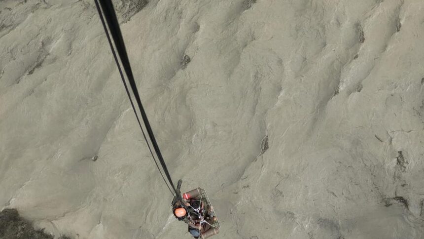


There were no rain forecasts, so no warning alert as such. But early Tuesday, massive floods on the Bhotekoshi river in Rasuwa, a district bordering China, killed at least nine people and left 19 missing.
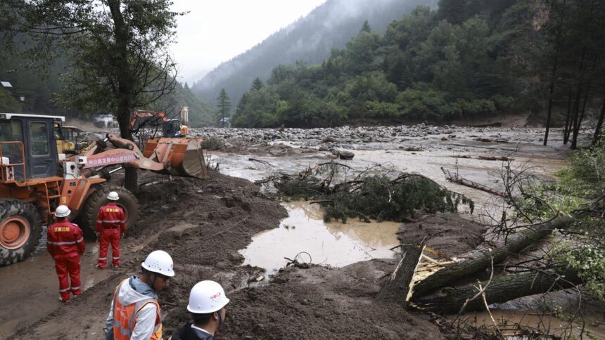
Nepal’s police and Army personnel carried out search and rescue operations throughout Tuesday, as authorities assessed the extent of the damage.
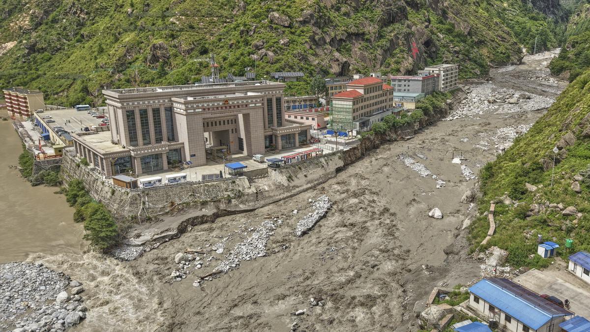
The floods also swept away the Nepal-China Friendship Bridge, disconnecting one of the key trade points between Nepal and China. Among the missing are 11 Nepalese, six Chinese, and two police personnel.
Officials and scientists, meanwhile, scrambled to find the cause of the flooding that occurred without rain.
“It is certain by now that it was not a rain-induced flooding,” said Binod Pokhrel, an associate professor at the Central Department of Hydrology and Meteorology at Tribhuvan University. “Weather forecasts and satellite data showed no rainfall in the Tibet region.”
Nepal’s mountainous terrain is vulnerable to monsoon floods that kill scores of people and damage property every year. While government authorities have been working on early warning systems, they have not been as effective as desired. Erratic rainfall, floods, landslides, and avalanches have become more frequent — and deadlier — in recent years, due in part to changing climate patterns, which are increasingly causing GLOFs (Glacial Lake Outburst Floods).
In an inventory prepared in 2020 by the Integrated Centre for Mountain Development (ICIMOD), of the more than 3,000 glacial lakes in Nepal, Tibet, and India, 47 were identified as potentially dangerous.
Cause unclear
After the Rasuwa flooding, the ICIMOD said in a statement that it is too early to definitively determine the exact cause of the flood event.
“However, we can confirm that extreme rainfall was not the cause. A comprehensive investigation is required, but we need to wait for the monsoon cloud cover to clear first to obtain clear satellite imagery for detailed analysis,” it said.
“While a GLOF or a Landslide Lake Outburst Flood is suspected, there is no conclusive evidence yet.”
ICIMOD’s 2021 inventory shows that one glacial lake upstream of the Trishuli River in the Tibetan Autonomous Region of China is categorised as high risk and needs close monitoring. According to a recent ICIMOD study, the size of glacial lakes in the upper basin increased by 33%, and their number by 16%, within three decades from 1990 to 2020.
Ngamindra Dahal, a water and climate analyst, says Nepal needs to adopt a multi-scale approach to mitigate the disasters it is facing, especially in the northern region.
“Rasuwa floods should not be viewed in isolation. I call them synchronised events, given similar flood events in the past in the northern region,” he said.
He stressed the need for a study based on local patterns in order to forecast — and respond to — such disasters. “Haphazard construction, including that of hydropower projects, can have cascading effects, resulting in floods.”
Mr. Dahal has been calling for a new approach to studying Nepal’s Himalayas by incorporating organic data and understanding.
“Authorities are not only ignoring local patterns; they are undermining science as well,” he said. “Their refusal to assimilate local knowledge and Nepali scientists — and their overreliance on those who may lack an exact understanding of the locality — is not helping either.”
Information-sharing issues
The surprise floods have also raised questions about whether there was any prior information from the Chinese side.
Officials said that a few weeks ago, China had issued a notice to exercise caution along the riverbanks of rivers originating in Tibet. But since there was no forecast for rain, the occurrence of floods, according to experts, raises suspicions that something unusual may have happened.
Mr. Pokhrel says it is not possible to forecast rainfall that leads to flooding days in advance.
“When such a notice was issued back then, and now floods have occurred, it raises the suspicion that this might have resulted from some kind of incident or accident,” he said
Nepal’s Department of Hydrology and Meteorology, which forecasts floods and rains, also says there is no established mechanism for information sharing on floods and rains from the northern side.
Mr. Dahal says Nepali authorities are also to blame, given the failure to recognise extreme weather events and work on preparedness measures.
Economic impact
Authorities said that besides the bridge linking Nepal and China being swept away, at least 24 container trucks with goods and 35 electric vehicles were also washed away. A customs port in Rasuwa and a hydropower project dam also suffered damage.
With the linking bridge gone, trade through the Rasuwa border point — Nepal’s second major trade point with China — has come to a complete halt. This route, officially opened in December 2014, was upgraded to an international checkpoint in 2017, allowing cross-border travel.
The border point, however, remained inoperable for three years as China decided to close it due to COVID-19 restrictions, before it was reopened in April 2023. Records at the Department of Customs show that 30–40 fully loaded cargo containers were entering Nepal via the Rasuwa border point until Monday.
Rains, floods, and landslides during the monsoon, which begins in June and lasts until September, are a major killer in Nepal, with 31 reported dead as of July 1 this year. In recent years, extreme weather events have been increasingly reported in the mountain regions, which is concerning due to the lack of quick response mechanisms compared to the plains.
Mr. Dahal says that while the monsoon is climbing to higher altitudes, rising temperatures are causing ice to melt faster. Studies suggest the Himalaya is melting twice as fast as the global average. “Chances are that the glaciers underneath could have melted suddenly due to rising temperatures, causing the early Tuesday floods in Rasuwa,” said Mr. Dahal. “More comprehensive studies are required urgently before it’s too late.”
(Sanjeev Satgainya is an independent journalist based in Kathmandu)