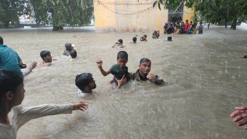


Representative image
| Photo Credit: AFP
Despite several places that get flooded repeatedly, adversely impacting people in terms of displacements, injury and even deaths, India lacks a comprehensive data-based flood severity index.
To address this lacuna, researchers from IIT Delhi and IIT Gandhinagar have come up with a District Flood Severity Index (DFSI) that takes into account the mean duration in days of all flooding events in a district, percentage of area that is historically flooded, total number of deaths, number of people injured, and the population in the district.

Though an entire district rarely gets flooded at any one point of time, according to the researchers, the need for creating a flood severity index at the district level was felt according to the researchers is because districts are the basic administrative and planning units in India, and most flood management-related measures are implemented with districts as a unit. But fundamentally, the data used in the study have been collected every year since 1967 by the Indian Meteorological Department (IMD). IMD collects and publishes data of disastrous weather events, wherein mainly riverine floods, and floods that inundate large areas get counted. Due to practical reasons, small flooding events or small cities that get flooded may be overlooked.
Addressing the shortcomings
“But the salient point about various indices that already exist is that they concentrate on the magnitude of the floods or the inundation caused by the floods. They don’t really account for the impact of the flooding events,” says Dr. Manabendra Saharia from the Department of Civil Engineering at IIT Delhi and the corresponding author of a study published in the journal Natural Hazards.
To address these shortcomings, the authors have developed a more comprehensive index to identify districts that experience severe floods and where the severity is defined not only by the magnitude of the floods but also by their impacts on people, Dr. Saharia says.
A first-cut measure
“Even if a district experiences a large number of flooding events, the entirety of the district is typically not flooded. In that case, we can find out what percentage of that district is historically flooded as we have a 40-year dataset developed and curated at IIT Delhi. This allows us to compute the percentage of flooded areas,” he says. “We have used all available data, including district population, to get a first-cut measure of how severe a flood is in an area.”

Dr. Saharia is quick to point out that what they have developed is an index and there is always room to improve it. For instance, the flood severity index in its current form does not take into account the aerial extent of agricultural fields that have been flooded as data on this are either not available or hard to access. “When more information becomes available, we will refine the index. But we wanted to go ahead with the datasets that we already have, either from IMD or things that we have developed ourselves,” he says.
Pointing out the fundamental difference between flooding of say the Indo-Gangetic Plain and urban areas, Dr. Sharad K. Jain from the Department of Civil Engineering at IIT Gandhinagar and a coauthor of the paper says that urban flooding occurs partly because of hydrometeorological reasons and also due to unwise urban development. “If the water management in urban areas improves, then some of these flood events may no longer happen,” says Dr. Jain.
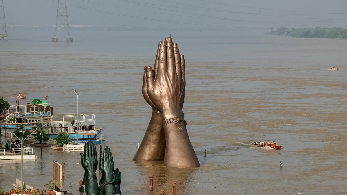
Besides heavy rainfall, unplanned development may be one of the reasons why Thiruvananthapuram district has experienced the greatest number of flooding events — more than 231, or more than four events per year on an average. Dhemaji, Kamrup, and Nagaon districts in Assam are three of the five districts in India that have experienced over 178 flooding events, or more than three events per year on an average.
Explaining why Thiruvananthapuram district has recorded the greatest number of flooding events, much higher than even districts in Assam and in States along the Indo-Gangetic Plain, Dr. Saharia says it is probably because of data collection protocols at that place.

How flood impact is measured
“There are certain limitations in the base data and that’s also the reason why we are not using the number of flooding events as the only factor for arriving at the district flood severity index,” clarifies Dr. Saharia. “Though Thiruvananthapuram is number one in terms of flooding events, it is absent in the top 30 districts in the flood severity index. Patna turns out to be number one on the index followed by many districts in the Indo-Gangetic Plain and in Assam.”
Besides the number of flood events, we take into account the aerial spread of the flooding, the number of people who actually live in that area and the impact of the flood on people, besides other factors. “So, if a relatively less populated district experiences a greater number of floods, it may be counted as a less severe flood-impacted district based on the parameters used to calculate the district flood severity index,” clarifies Dr. Jain. “Since the index is now available, we hope that this will motivate collection and use of data of more variables at finer spatial resolution.”
Published – August 03, 2025 10:18 am IST