


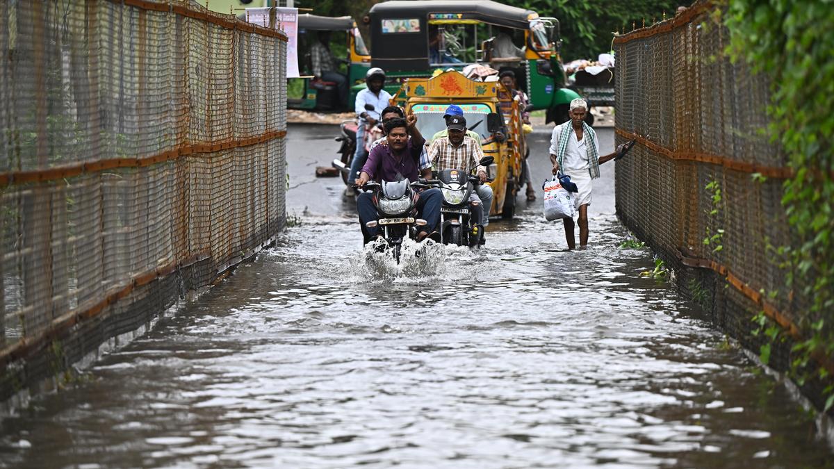

People use the Gunadala Pedda Vantenain Vijayawada on Wednesday despite water overflowing on it.
| Photo Credit: K.V.S. GIRI
The India Meteorological Department (IMD), Amaravati, on Wednesday issued red alerts for South Coastal Andhra Pradesh on August 14 (Thursday).
Even as heavy rain lashed the districts of NTR, Guntur, Palnadu, Krishna, Eluru, Dr. B.R. Ambedkar, and Bapatla on August 13 (Wednesday), the districts have to brace for heavy to very heavy or extremely heavy rainfall on Thursday as well, according to a release from the India Meteorological Department (IMD), Amaravati. A red alert has also been issued for West and East Godavari districts.
For North Coastal A.P., an orange alert has been issued. The orange alert stays for all the districts, except for Rayalaseema, on August 15 (Friday) as well.
During the 24 hours between 8.30 a.m. on Tuesday and the corresponding time on Wednesday, Mangalagiri recorded the highest of 19 cm or 190 mm of rainfall, according to the IMD. Last year, when the Budameru swelled causing floods in Vijayawada and surrounding areas, Mangalagiri in Guntur district had recorded nearly 300 mm (30 cm) in 24 hours. Mangalagiri was followed by Tenali, also in Guntur district, which recorded 18 cm, and Karamchedu of Bapatla district, which recorded 15 cm. Amaravati recorded 14 cm, while Avanigadda of Krishna district received 13 cm.
Bapatla, Guntur, Atchampeta, Gudivada, and Piduguralla also recorded more than 10 cm during the 24-hour period. While rain pounded Vijayawada all night, there is conflicting information about the amount of rainfall received by the city. While the IMD puts the number at 30 mm, the district administration has put the number at 90 mm. According to the district information, Ibrahimpatnam received 142.8 mm. Many streams in Palnadu, NTR, and Guntur districts were overflowing on Wednesday, causing traffic jams at some places. Fishermen have been cautioned against going into the sea for the next five days, while people in low-lying areas have been asked to be alert. Those living on hill slopes also have to be careful since there is a possibility of rockslides, the IMD said.
Meanwhile, the low-pressure area over west-central and adjoining northwest Bay of Bengal, off North Andhra Pradesh and South Odisha, which was formed on Wednesday early morning, persisted over the same region at 8.30 a.m. The associated upper air cyclonic circulation extends up to 7.6 km above mean sea level, tilting southwards with height. It is likely to move west-northwestwards and become well marked during the next 24 hours, according to the IMD.
It is likely to move across North Coastal Andhra Pradesh and South Odisha during the next 48 hours.
Published – August 13, 2025 11:30 pm IST